
Estimating the Threshold of Detection on Tree Crown Defoliation Using Vegetation Indices from UAS Multispectral Imagery
Otsu, K.; Pla, M.; Duane, A.; Cardil, A.; Brotons, L. Estimating the Threshold of Detection on Tree Crown Defoliation Using ...
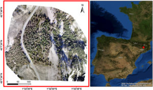
Quantifying pine processionary moth defoliation in a pine-oak mixed forest using unmanned aerial systems and multispectral imagery
Cardil A, Otsu K, Pla M, Silva CA, Brotons L (2019) Quantifying pine processionary moth defoliation in a pine-oak mixed ...
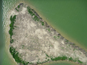
Monitoring opencast mine restorations using Unmanned Aerial System (UAS) imagery
Padró, J. C., Carabassa, V., Balagué, J., Brotons, L., Alcañiz, J. M., & Pons, X. (2019). Monitoring opencast mine restorations ...
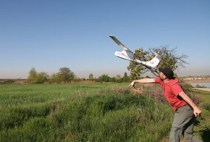
Uso con éxito del aeromodelismo para el seguimiento de la fauna
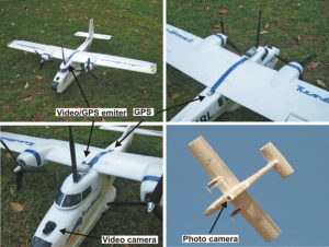
Sardà-Palomera, F., Sazatornil, V., Quilis, M., Sardà-Amills, F. 2009. Uso con éxito del aeromodelismo para el seguimiento de la fauna. Quercus, 286: ...
Reply to ‘a comment on the limitations of UAVs in wildlife research – the example of colonial nesting waterbirds’
Sardà?Palomera, F. , Bota, G. , Sardà, F. and Brotons, L. (2018), Reply to ‘a comment on the limitations of ...
Fine?scale bird monitoring from light unmanned aircraft systems
SARDÀ?PALOMERA, F. , BOTA, G. , VIÑOLO, C. , PALLARÉS, O. , SAZATORNIL, V. , BROTONS, L. , GOMÁRIZ, S ...
Unmanned aircraft systems to unravel spatial and temporal factors affecting dynamics of colony formation and nesting success in birds
Sardà?Palomera, F. , Bota, G. , Padilla, N. , Brotons, L. and Sardà, F. (2017), Unmanned aircraft systems to unravel ...
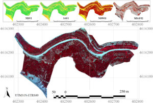
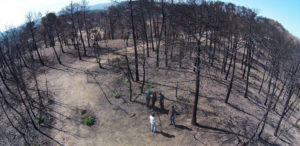
Greenness Indices from a Low-Cost UAV Imagery as Tools for Monitoring Post-Fire Forest Recovery
Larrinaga, A.R.; Brotons, L. Greenness Indices from a Low-Cost UAV Imagery as Tools for Monitoring Post-Fire Forest Recovery. Drones 2019, 3, 6. https://www.mdpi.com/2504-446X/3/1/6 ...
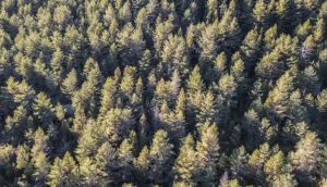
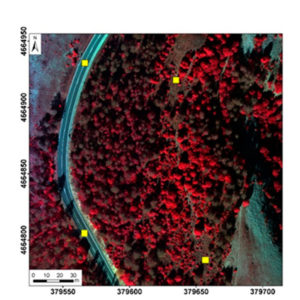
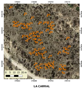
Calibrating the Severity of Forest Defoliation by Pine Processionary Moth with Landsat and UAV Imagery
Otsu, K., Pla, M., Vayreda, J., & Brotons, L. (2018). Calibrating the Severity of Forest Defoliation by Pine Processionary Moth ...
Potential of UAV images as ground-truth data for burn severity classification of Landsat imagery: approaches to an useful product for post-fire management
Pla, M.; Duane, A.; Brotons, L. (2017). Potencial de las imágenes UAV como datos de verdad terreno para la clasificación ...