
Cardil A, Otsu K, Pla M, Silva CA, Brotons L (2019) Quantifying pine processionary moth defoliation in a pine-oak mixed forest using unmanned aerial systems and multispectral imagery. PLOS ONE 14(3): e0213027. https://doi.org/10.1371/journal.pone.0213027
https://journals.plos.org/plosone/article?id=10.1371/journal.pone.0213027
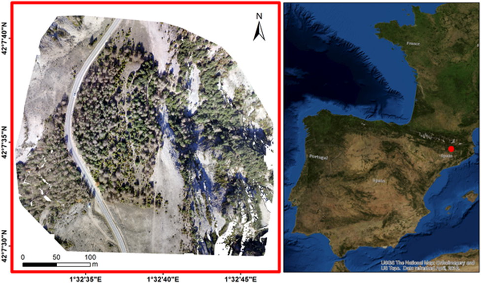
Pine processionary moth (PPM) feeds on conifer foliage and periodically result in outbreaks leading to large scale defoliation, causing decreased tree growth, vitality and tree reproduction capacity. Multispectral high-resolution imagery acquired from a UAS platform was successfully used to assess pest tree damage at the tree level in a pine-oak mixed forest. We generated point clouds and multispectral orthomosaics from UAS through photogrammetric processes. These were used to automatically delineate individual tree crowns and calculate vegetation indices such as the normalized difference vegetation index (NDVI) and excess green index (ExG) to objectively quantify defoliation of trees previously identified. Overall, our research suggests that UAS imagery and its derived products enable robust estimation of tree crowns with acceptable accuracy and the assessment of tree defoliation by classifying trees along a gradient from completely defoliated to non-defoliated automatically with 81.8% overall accuracy. The promising results presented in this work should inspire further research and applications involving a combination of methods allowing the scaling up of the results on multispectral imagery by integrating satellite remote sensing information in the assessments over large spatial scales.