
Padró, J. C., Carabassa, V., Balagué, J., Brotons, L., Alcañiz, J. M., & Pons, X. (2019). Monitoring opencast mine restorations using Unmanned Aerial System (UAS) imagery. Science of the Total Environment, 657, 1602–1614. https://doi.org/10.1016/j.scitotenv.2018.12.156
https://www.sciencedirect.com/science/article/pii/S0048969718350010?via%3Dihub#ec0005
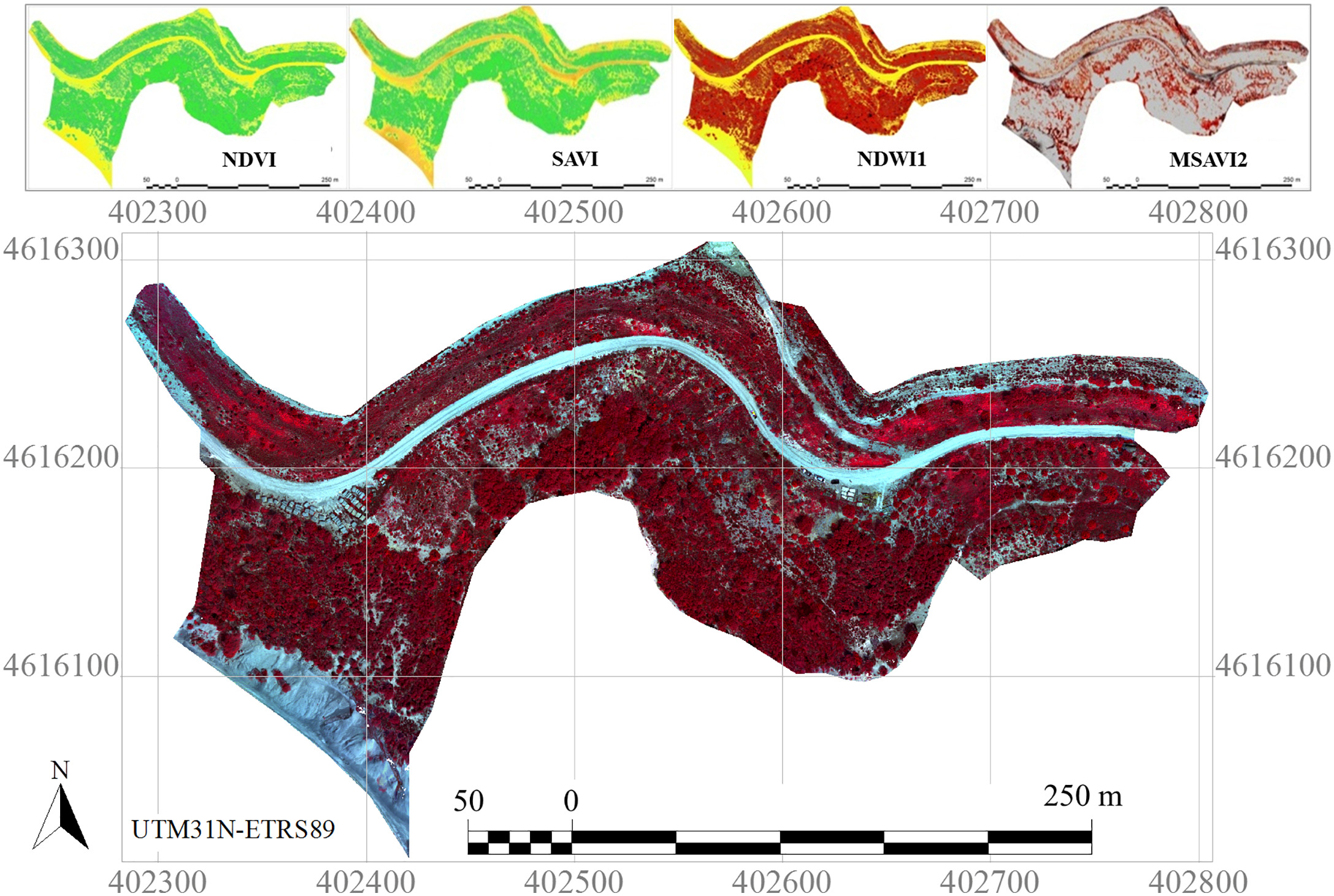
Open-pit mine is still an unavoidable activity but can become unsustainable without the restoration of degraded sites. Monitoring the restoration after extractive activities is a legal requirement for mine companies and public administrations in many countries, involving financial provisions for environmental liabilities. The objective of this contribution is to present a rigorous, low-cost and easy-to-use application of Unmanned Aerial Systems (UAS) for supporting opencast mining and restoration monitoring, complementing the inspections with very high (<10?cm) spatial resolution multispectral imagery, and improving any restoration documentation with detailed land cover maps. The potential of UAS as a tool to control restoration works is presented in a calcareous quarry that has undergone different post-mining restoration actions in the last 20?years, representing 4 reclaimed stages. We used a small (<2?kg) drone equipped with a multispectral sensor, along with field spectroradiometer measurements that were used to radiometrically correct the UAS sensor data. Imagery was processed with photogrammetric and Remote Sensing and Geographical Information Systems software, resulting in spectral information, vegetation and soil indices, structural information and land cover maps. Spectral data and land cover classification, which were validated through ground-truth plots, aided in the detection and quantification of mine waste dumping, bare soil and other land cover extension. Moreover, plant formations and vegetation development were evaluated, allowing a quantitative, but at the same time visual and intuitive comparison with the surrounding reference systems. The protocol resulting from this research constitutes a pipeline solution intended for the implementation by public administrations and privates companies for precisely evaluating restoration dynamics in an expedient manner at a very affordable budget. Furthermore, the proposed solution prevents subjective interpretations by providing objective data, which integrate new technologies at the service of scientists, environmental managers and decision makers.